

Upon the advent of Google Maps, a powerful and widely used location-based mapping tool, paper maps were rendered obsolete. Every day, the mapping service improves and becomes more user-friendly.
The name “Google Maps” has become almost interchangeable with “location-based mapping service” due to the widespread use of Google’s flagship product. The availability of helpful resources like speed limit checkers, which eliminate one of the biggest challenges—finding your way to an unknown location or destination—may account for some of this fervent appeal.
Have you been looking for a vegetarian restaurant in your new city? You can count on Google Maps to get you where you need to go. Do you wish to find the most popular areas of the attraction you are currently exploring? You can get help from Google Maps.
Google Maps is the default mapping service on Android devices. Google Maps is convenient, but it comes with a major drawback. As a result of its persistent storage of users’ browsing histories, Google has earned a notoriously bad rap from the general public. So, if you care about your privacy, you should stop using Google Maps immediately and start using anything else.
Alternatives to Google Maps
There are several good reasons to look into switching to a different mapping service besides privacy worries. Although they are not Google, these alternatives fill in some of Google Maps’ gaps in functionality.
Google Maps’ offline maps aren’t as detailed as those provided by other mapping services, but they’re better than nothing. These apps not only supply relevant information like driving statistics and other map categories, traffic alerts and updates, and more, but they also supply additional beneficial data.
9 Best Google Maps Alternatives You Can Use
Because of these drawbacks, you should look for an alternative to Google Maps that has better features. If you’re looking for an alternative to Google Maps, these are the best location-based services that can do the job.
1. Waze
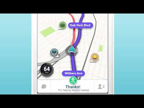
Waze is a crowdfunded mapping service for personal computers, Android, and iOS smartphones. The user-friendly and interactive system also lets you alert nearby drivers to incidents like traffic shifts, speed traps, bottlenecks, and other hazards. Google purchased Wave in 2013 as a separate app from Google Maps due to the app’s immense popularity.
When it comes to things like gas prices, road construction, accidents, speed traps, and police stations, Waze users are always on top of things. Furthermore, it enables the monitoring of users’ positions in real time (if they permit).
You can do all of these things and more with the Live map, including research, route planning, marking key locations with pins, discovering hidden gems, and uploading camera photographs. You can make your map unique to you with the aid of the Waze Map Editor.
2. Apple Maps

If you’re concerned about your personal information being shared, Apple Maps is a great alternative to Google Maps. Apple Maps has come a long way since it was first introduced, and if you have an iPhone, you won’t want to use any other app to look for a location or see the path to your destination. Apple spared no expense in making its built-in internet mapping services secure, and the company has fixed the accuracy issues and glitches that plagued the product’s debut.
There are several features that Google Maps has that Apple Maps does not, and there are not as many user reviews of different businesses on Apple Maps as there are on Google Maps. If you are in the United States, for instance, you may find out the location of stop signs and traffic lights, as well as the correct lane in which to drive.
3. MapQuest
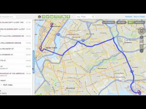
MapQuest is a great alternative to Google Maps if you rely on public transportation to get about. You can find the best local transportation service along your route with the help of MapQuest, a mapping service that is available both online and as an app for Android and iOS smartphones. Access real-time data on the local transit options available to you.
If these features weren’t impressive enough, MapQuest can also calculate how many calories you’ll burn if you choose to walk there instead of taking a car. Wow, that’s a great bonus at the end!
In addition to the standard mapping functionality, MapQuest also provides services such as automatic re-routing, real-time traffic conditions, ETA notifications for cameras, accidents, and delays, location sharing, and weather forecasts. There are several of Google Maps’ standard features available in MapQuest as well, including turn-by-turn directions, saved routes, a satellite view, and a list of attractions in the area.
4. Bing Maps

Before Google Maps came along, there existed Microsoft’s MapPoint web mapping service. It was rebranded as Bing Maps later to increase brand recognition. Competing head-on with Google Maps, it quickly gained popularity thanks to innovative features like traffic overlay and 3D views. For the benefit of city planners, Bing Maps also includes a detailed ordinance survey map of the United Kingdom.
It gets the most efficient routes to different locations from Google Maps, while Bing apps usually provide faster results. Considering Bing Maps’ cutting-edge 3D views, OS maps, and Street View, not to mention its sleek and user-friendly design, it’s hard to pass up giving it a shot. It’s worth noting that Bing Maps shares many similarities with Google Maps, including its road, aerial, and streetside layers. Bing Maps not only provides separate walking and driving maps, but also allows you to add stops to your itinerary and print it out.
5. Here WeGo
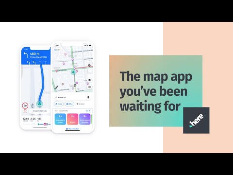
Formerly known as Here Maps, Here WeGo can be found pre-installed on the in-car GPS navigation systems of luxury brands like Mercedes-Benz, Audi, and BMW. Millions of people use Here WeGo because of its straightforward design and not just because they drive cars. Here WeGo maps are accessible in over 200 countries and provide navigation to help you choose the best path to your intended destination.
When finished, it gives you the most up-to-date data and fare details for local public transit. You may also see details like speed traps, construction zones, and police presence. Faster travel choices like public transit, cabs, and carpooling are all included in the app. Here WeGo also provides offline maps, so you may download an entire continent’s worth of maps and use them later, along with offline directions.
6. Maps.Me

Maps.Me, which can be accessed in app and browser form, contains all the standard elements of a high-quality mapping service, such as traffic reports, public transit options, and cycling directions. It works similarly to Google in that you can save maps locally for usage when you’re in an area with spotty service. The convenience of this is much appreciated, especially when traveling to a foreign country or city.
Anyone who finds oneself in strange cities frequently can benefit greatly from using Maps.me. It highlights the city’s must-see attractions and must-eat restaurants. An ever-expanding database of hiking trails throughout the world is also included.
While making travel plans, you can save these spots and recommend them to a friend. There are dozens of main categories and subcategories in the online edition of Maps.Me, making it easy to find what you’re looking for.
7. OsmAnd

Since it can be used without an internet connection, OsmAnd, a free alternative to Google Maps, has become very popular. You can use these maps even if you don’t have access to the internet to locate your way.
One of the best features of this high-tech, open-source alternative to Google Maps is its offline maps, which work regardless of your location’s reception. These maps are as detailed as their Ordnance Survey counterparts. Since maps are frequently updated, you can rest assured that you are never using an outdated one.
While the user interface isn’t particularly pleasing to the eye, it is highly customizable thanks to filters that let you selectively explore parts of the map. Toll roads, street lights, road surface, and road condition are just some of the options available. The number of map downloads is capped at seven on the free version of the software. If you need more features, you’ll have to spring for the upgraded plan.
8. CityMapper

CityMapper’s focus makes it more localized than Google Maps, but it also outperforms its competitors in its primary functionality. Public transit riders in the world’s most populous cities will find this map resource useful. Public transportation options such as buses, metro, subways, trains, ferries, Uber car-sharing, and trams are all displayed in the app’s multi-mode travel planner.
For all the world’s major cities, CityMapper has a database of public routes that is constantly updated, sends you alerts about traffic, route diversions, and precipitation, and lets you create a “favorite” list of locations.
It has a function called “Go Assistant” that provides real-time navigational guidance and suggestions. When using CityMapper, you may also order an Uber ride directly from within the app. It finds every possible route to a location and displays the fastest one.
9. OpenStreetMap
If you need a web mapping service, go no further than OpenStreetMap, a user-friendly, feature-rich, and free alternative. The brightly colored maps detail the various tiers, make it easier to plan out routes, and include options for cycling and strolling.
Entering your starting point and final destination into the search bar will bring up a map of your path. After doing a search, the resulting map can be saved to your phone. These maps can be saved for offline viewing by loading them at a later time.
As an alternative to GoogleMap, OpenStreetMap is preferable for casual usage because to its lack of location tracking and protection of user confidentiality. The crowdfunded, open-source mapping application lets users add any address or intersection to an already existing database.
Conclusion
Accurate navigation and route planning are made possible by the aforementioned mapping services. Some apps are designed to do one thing really well, like giving you directions in a strange city or providing information about public transportation. These apps can replace Google Maps because of their useful functions.
